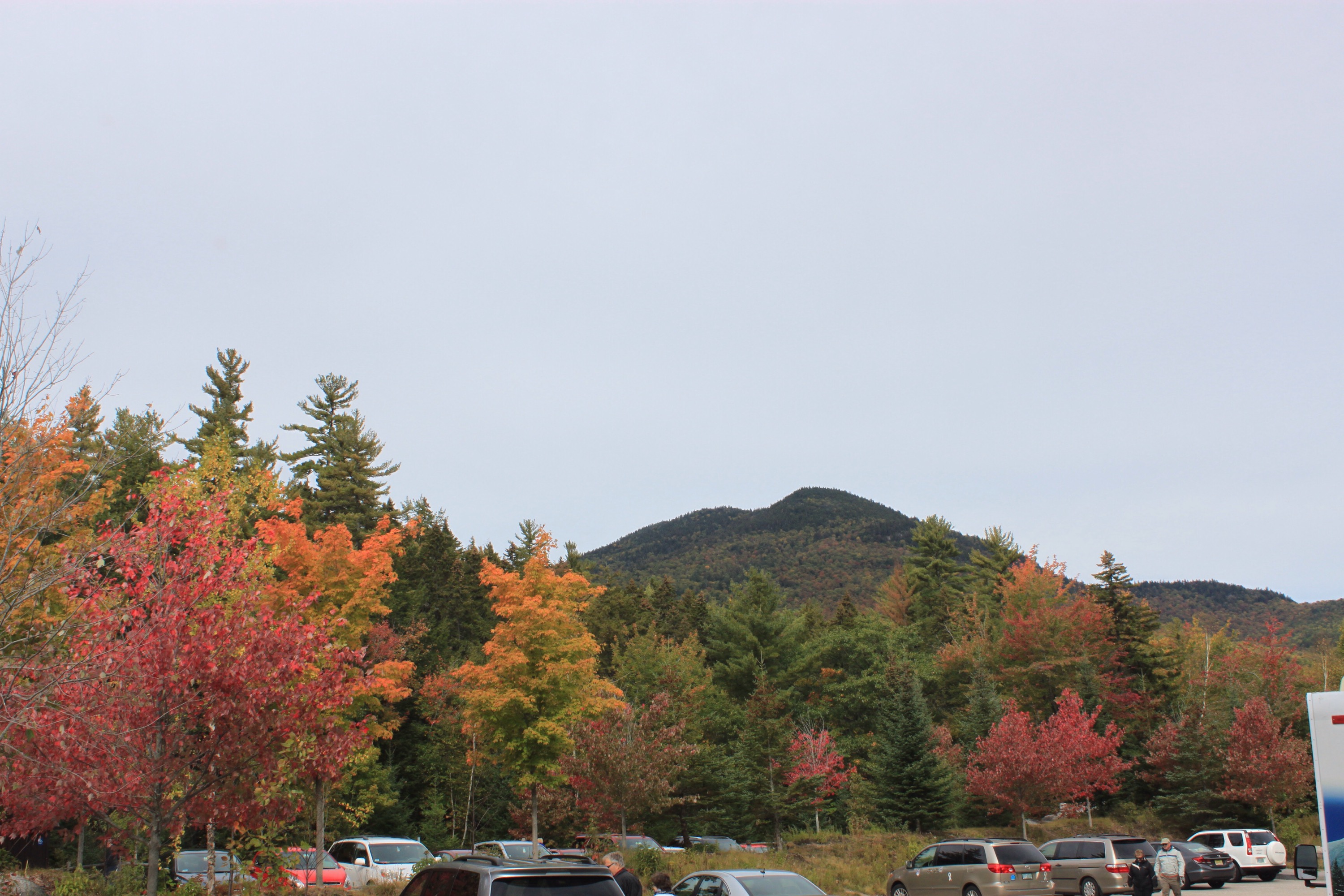
CHANGING OF THE COLORS
As some of you know one of the reasons for this trip was to see the foliage in its splendor. Today was absolutely spectacular. We are back in The White Mountains of New Hampshire and drove highway 112 from Conway to Lincoln. It is a corridor of color. Most of the pictures were through the windshield, not the best but injoyable anyway.

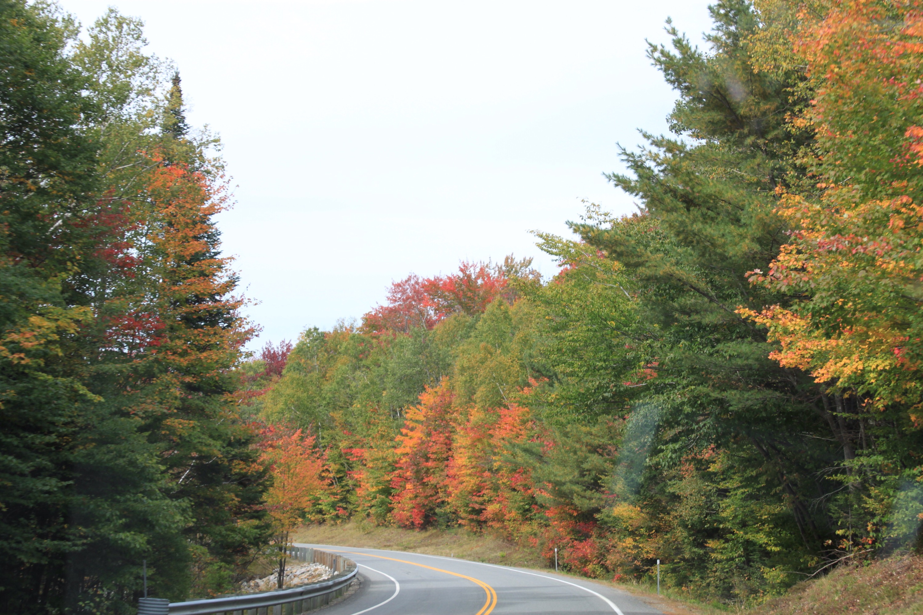 Every turn was spectacular

These are not flowers, just trees and bushes.

The whole hillsides were vivid.


A water fall for variety

And a covered bridge. Probably a hundred more pictures of beautiful trees. We were in awe for several hours.
We tried some vidio through the window too. When we get home we will post if they come out okay.
Fuhry n Larry
W
On the Road — 2015
Getting ready to go on the road again.
We will be leaving later this week, heading north to Winkler, Manitoba to have some work done on the motor home at the factory. We have had some problems with the electricaly powered Murphy Bed and they have come up with a manual option to replace it.
From Winkler we will drop back into North Dakota and head east through Northern Minnesota, Northern Michigan and then cross the Mackinaw straight between Lake Michigan and Lake Huron. We will work our way down the Peninsula and enter Canada at Sarnia, Ontario heading for Toronto, Ottawa and into Quebec. We will spend time in Montreal, Quebec City and wherever in-between.
Not sure if we will have time to do New Brunswick, Nova Scovia, Prince Edward Island or Newfoundland. One could spend several months just in the Maritime Provinces. But as we get into fall and the foliage begins to turn we will start back. Following the colors, we will work our way across Maine, New Hampshire, and Vermont. Somewhere we must get to the coast for a seafood feast. No better chance to get fresh Lobster.
How we travel back home remains to be seen. We do plan on being home by mid November.
We will start a new blog site and if you want to follow along go http://fuhrynlarry2015.wordpress.com. Select to “Follow”, located in the lower right hand corner of the screen, and you will get a notice each time we add a blog.
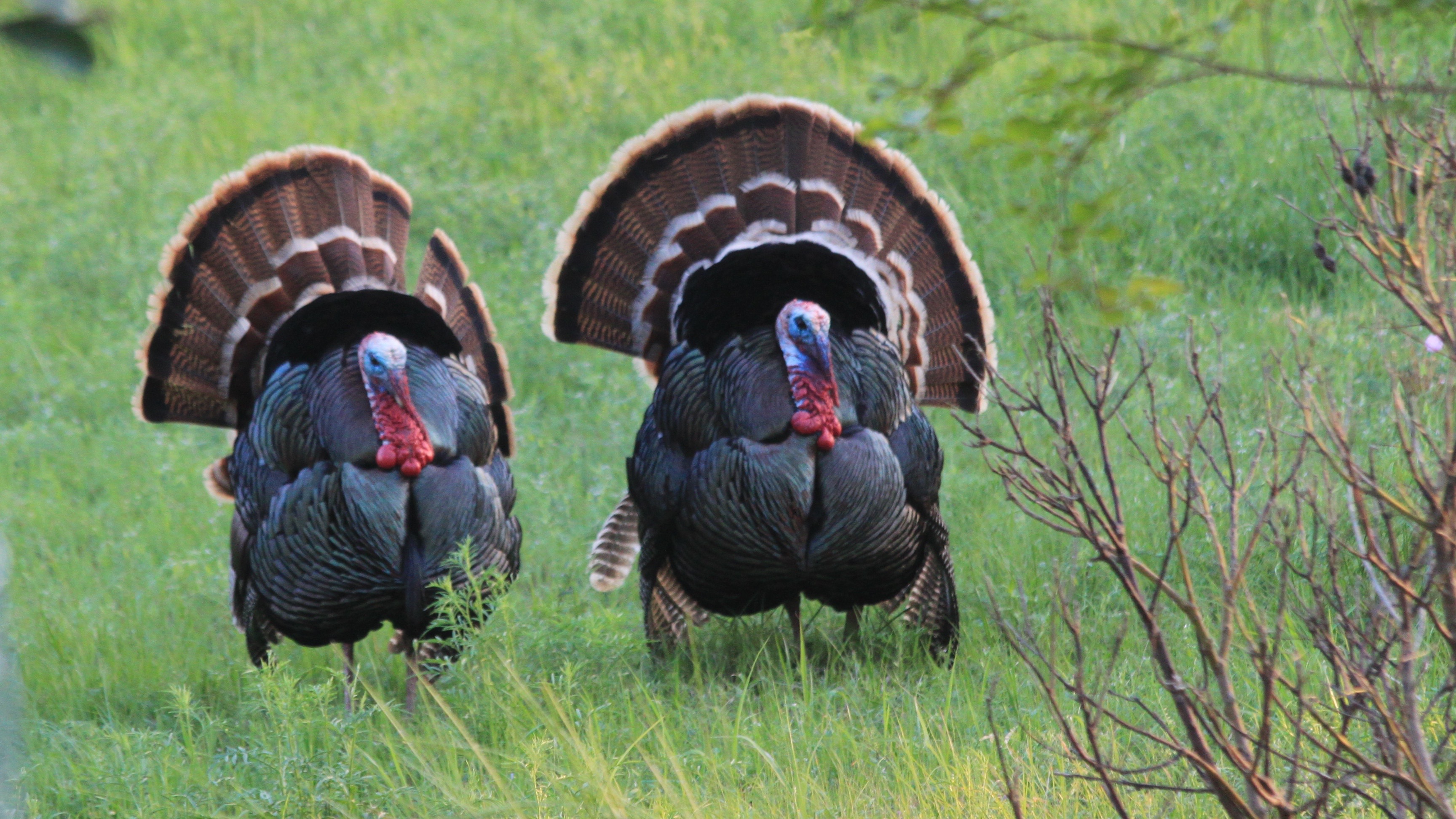
Think of us as Two Old Turkeys wandering through life. Similar to the two shown here, taken in the green belt behind our home. We were treated to a beautiful courting display last spring.
fuhrynlarry
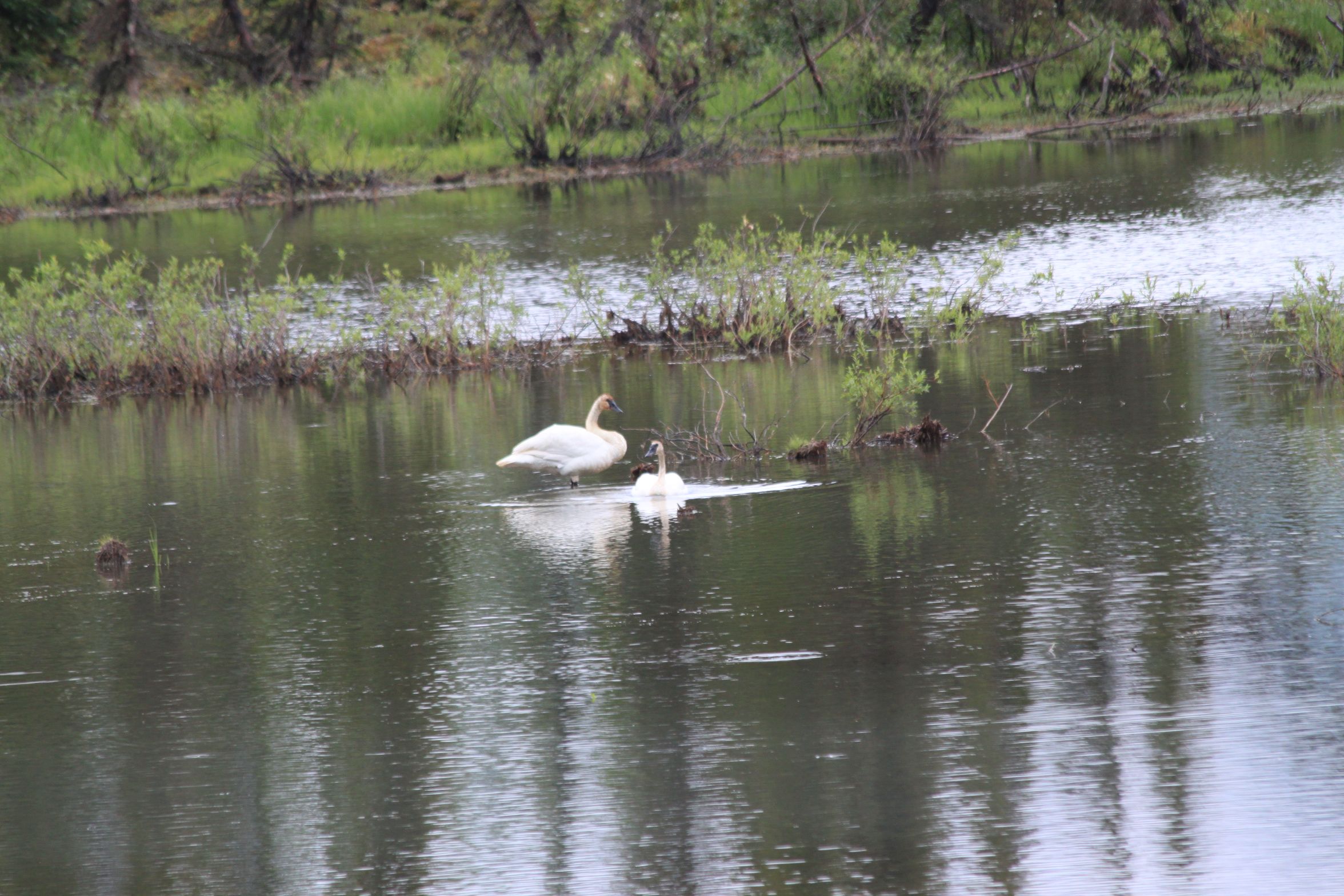
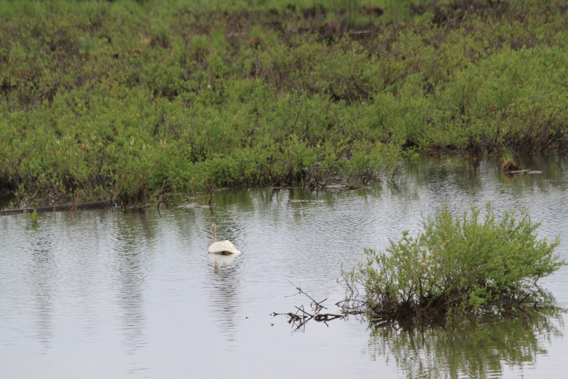
SWANS IN MOTION REPEAT
The slideshow did not work in the first “Swans in Motion” so I have inserted the pictures here. Picture number one is two swans a swimming, followed by one seeing a fish or frog or something causing a splash and taking off to see what it was. When the swan gets close, note the ripples in the water, it puts on the brakes and begins searching, and then tries to dive. Last picture: The partner is undisturbed by all the action.

TWO SWANS SWIMMING
ONE SEES OR HEARS FISH OR FROG JUMP

STARTS TAKE OFF

WINGS FLAPPING
FEET PADDLING
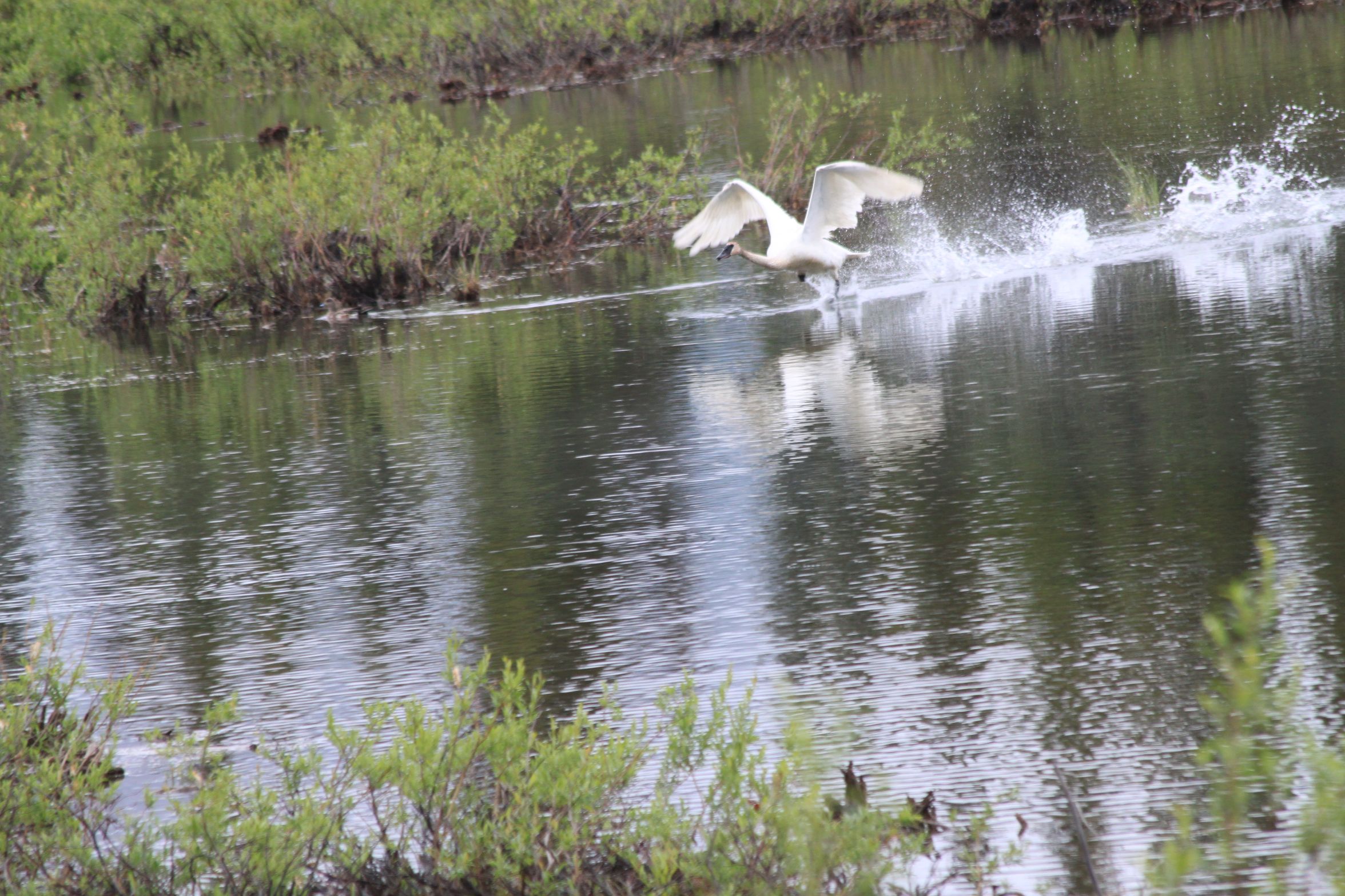
ON THE WAY
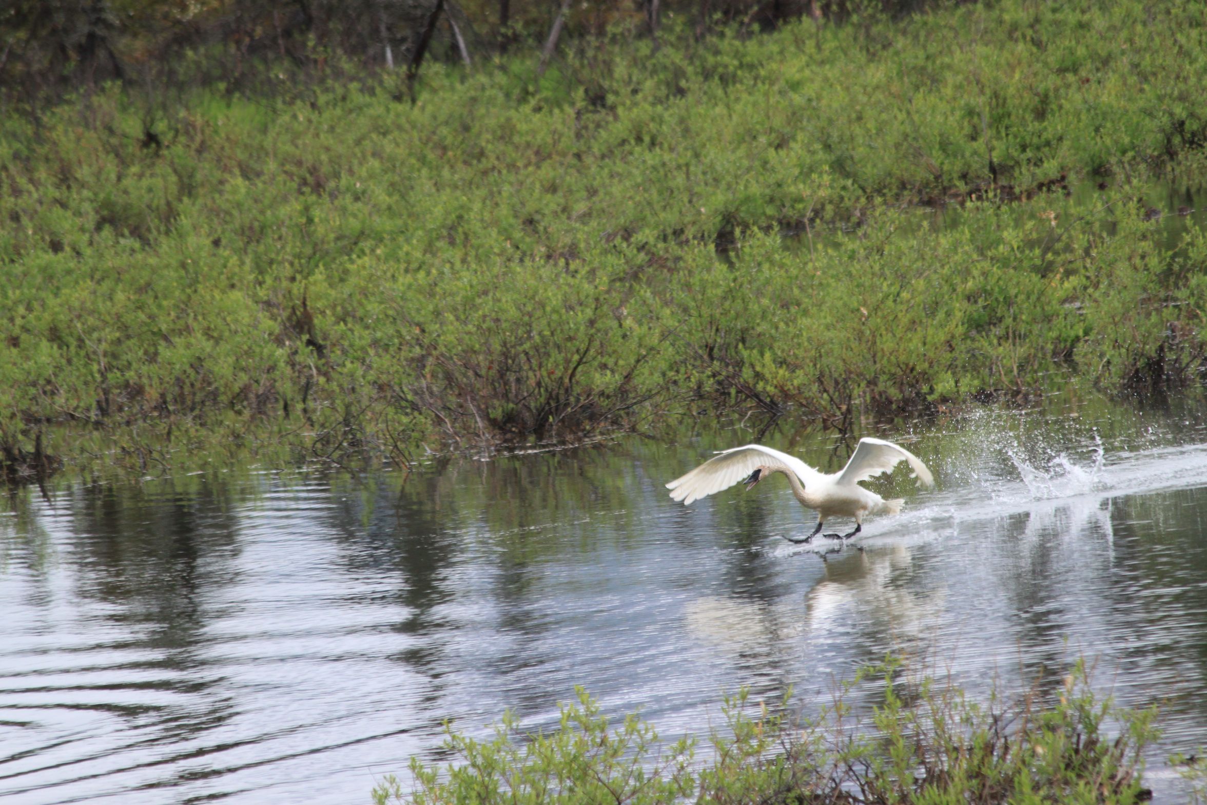
PUT ON THE BRAKES

LOOKING FOR FOOD

HEAD UNDER WATER

PREPARE TO DIVE

ONE SWAN SWIMMING
SWANS IN MOTION
We are back home. Got here on the 6th. Thought I would try to upload a couple of Slide Shows.
In an earlier post I showed a couple of pictures of the Swans. Here is the rest of the series. It starts out with two swans a swimming, followed by one seeing a fish or frog or something causing a splash and taking off to see what it was. When the swan gets close, note the ripples in the water it puts on the brakes and begins searching, and then tries to dive.
Last picture: The partner undisturbed by all the action.
Link did not work. Try as a Gallery.


fuhrynlarry
INTERNATIONAL PEACE GARDENS
INTERNATIONAL PEACE GARDEN
Located along the border between Canada and the United States, the gardens were conceived by Dr.Henry T. Moore, a horticulturist for the Ontario Department of Agriculture, in 1928. Dr. Moore describes the area as follows:
“What a site greeting the eye! Those undulating hills rising out of the endless prairies are filled with lakes and streams. On the south of the recognizable boundary, wheat everywhere; and on the north, the Manitoba Forest Reserve. What a place for a garden!”
Work began on the park in 1934 by the Civilian Conservation Corp, which continued until 1941 at the beginning of World War II. Work has continued through out the years and plans for future development are still being formulated. A 911 memorial was recently added.

VIEW FROM EAST
The gardens are about a mile long from end to end with the center on the border between Canada and the United States. Note the stream running on the border and the Peace Towers in the distance.
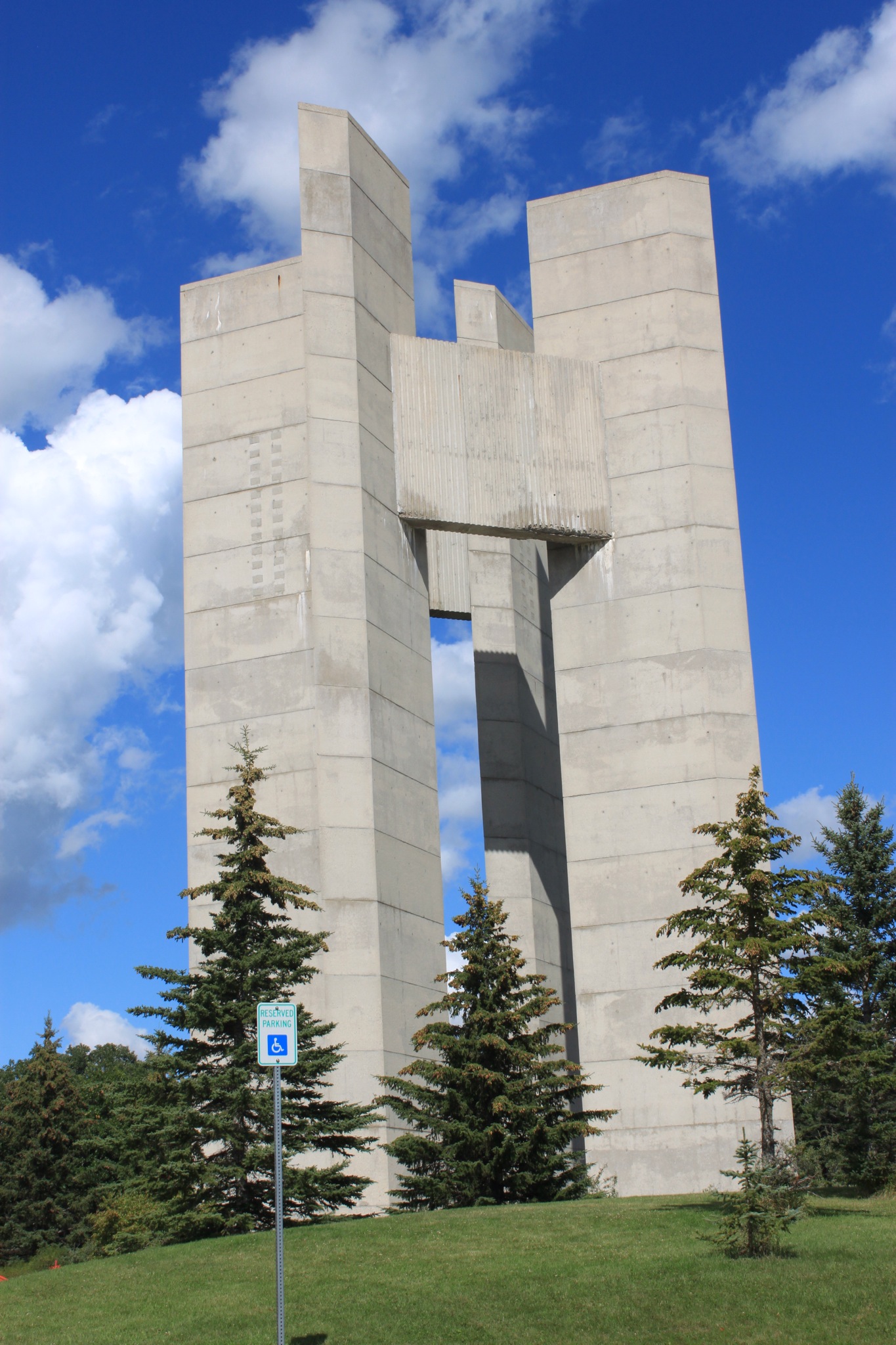
PEACE TOWERS
The Peace Towers are four separate towers, representing the four corners of the Earth.

CARILLON BELL TOWER
The 14 bells in the bell tower range in size from 250 to 2000 pounds and were cast in England in 1931. The bells play every 15 minutes during warm months.

TYPICAL FLOWER BED THROUGHOUT THE GARDENS
On the west end of the gardens is the Peace Chapel. Sitting inside leaves one in a very calm peaceful state. Around the walls are numerous quotations, all which emphasizes peace, such as the following.
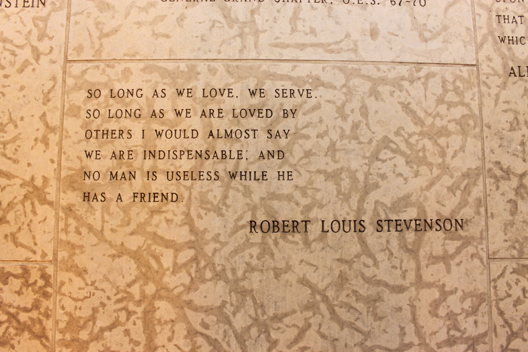
All in all it is a very beautiful place to spend a day.
fuhrynlarry
MENNONITE HERITAGE CENTER – STEINBURG, MANITOBA
A great place to study the history of the Mennonite immigration to the Americas. In the early 1500s, during the Martin Luther movement, there was tremendous persecution and there was a large number of Mennonites that immigrated to Poland and later to Ukraine in the mid 1700s. In the mid 1800s many of them immigrated to the Americas, United States and Canada. After schooling issues with the governments, some immigrated to South Amarica.
Those that immigrated to Canada and the United States brought with them their methods and skills that were used in theUkraine. Those would include the education, farming, home building, the art of building windmills as well as the commercial practices. Those are all well covered at the center.
One of the practices was building the barn connected to the house. The barn would be larger than the house in order to provide space for cows, chickens, sheep, oxen, horses, equipment and trade facilities required to maintain the farm.
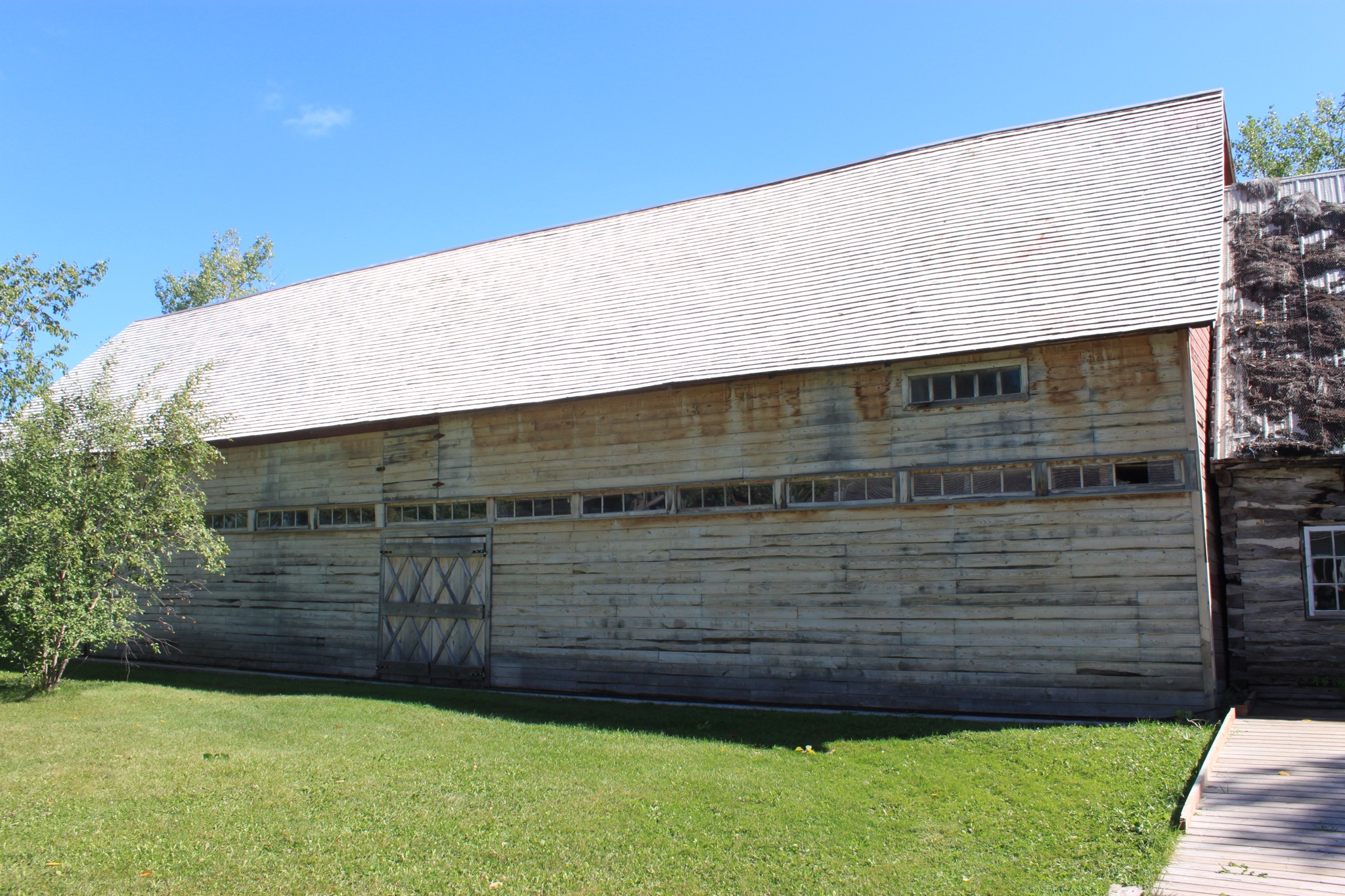
THE BARN PORTION

HOUSE PORTION
Something new to me was the construction of small windmills that could be moved around the farm. These could then be used for tasks such as sawing wood, pumping water, grinding wheat and so on.

PORTABLE WINDMILL
The Canadian government set aside 8 townships for the Mennonites. Each township would have a commercial center where there would be a school, church, Blacksmith, Tinsmith, saddle and harness maker, General Store and sometimes a print shop the communities were very close knit through church school, barn raisings and other needs.
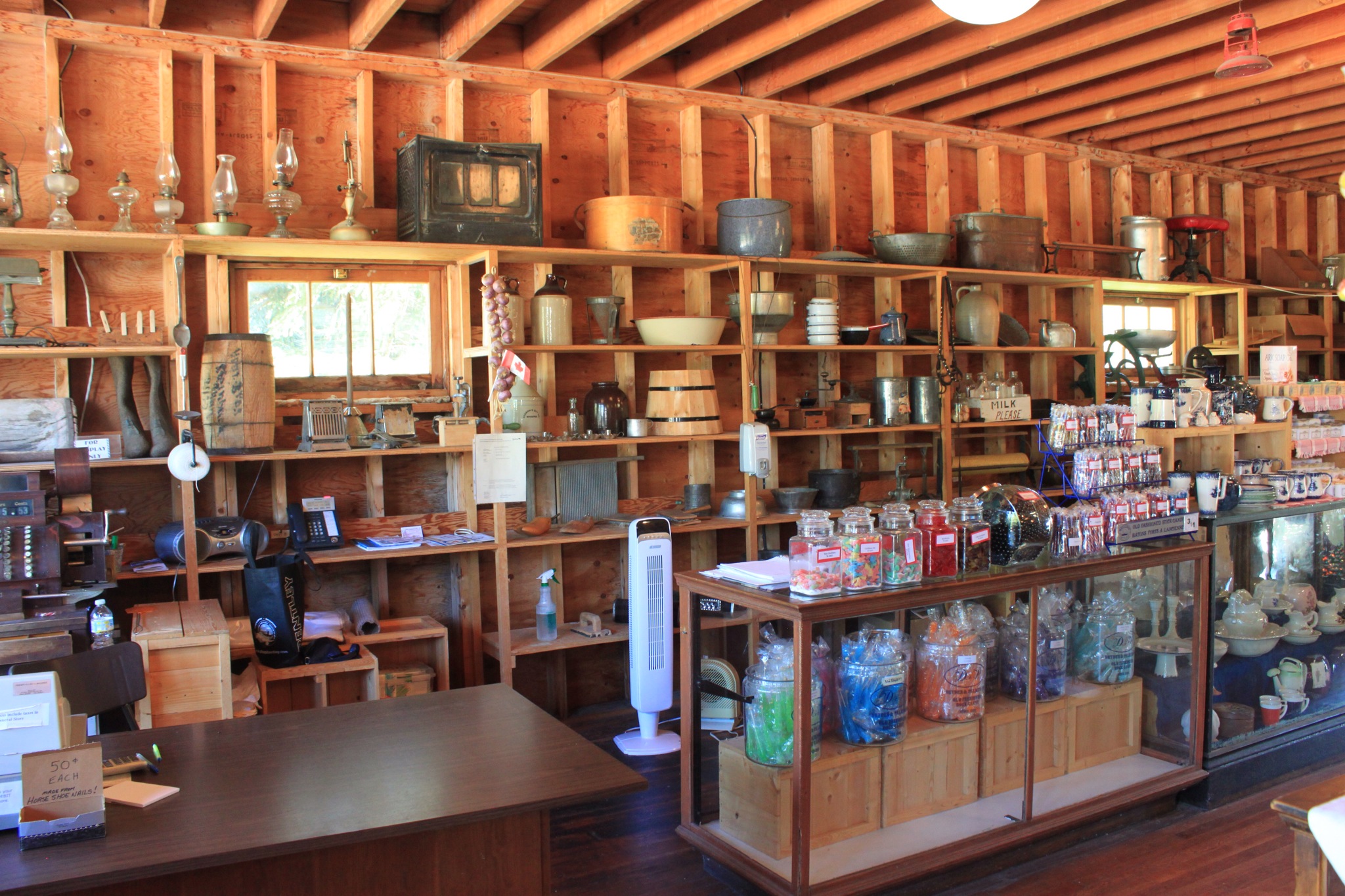
TYPICAL GENERAL STORE
Each facility was available to tour and interesting to study. Finances must have been tight as a family would not be able to have a large storage of product on hand. A bottle of castor oil was thirty cents, but a teaspoonful was 2 cents.


I could go on as there was a lot to talk about, but will close.
fuhrynlarry
FORT ST. JAMES, BC
FORT ST. JAMES, located on Stuart Lake, was a major fur trading center for the Hudson Bay Company. It was fairly central and furs could be transported to the Pacific Ocean over lakes and trails established by the Carrier Indians. There is a string of large lakes between Fort St. James plus the Skena River that could be navigated. There are 40 portages between here and the coast.
The fort, originally established in 1806, has been replicated as it was in the mid 1800. They paid a lot of attention to constructing the building using the same building techniques as used then. The major difference between two construction techniques can be seen in the pictures. One used square posts at the corners with horizontal planks between the posts, while the other used overlapping logs at the corners.

WAREHOUSE
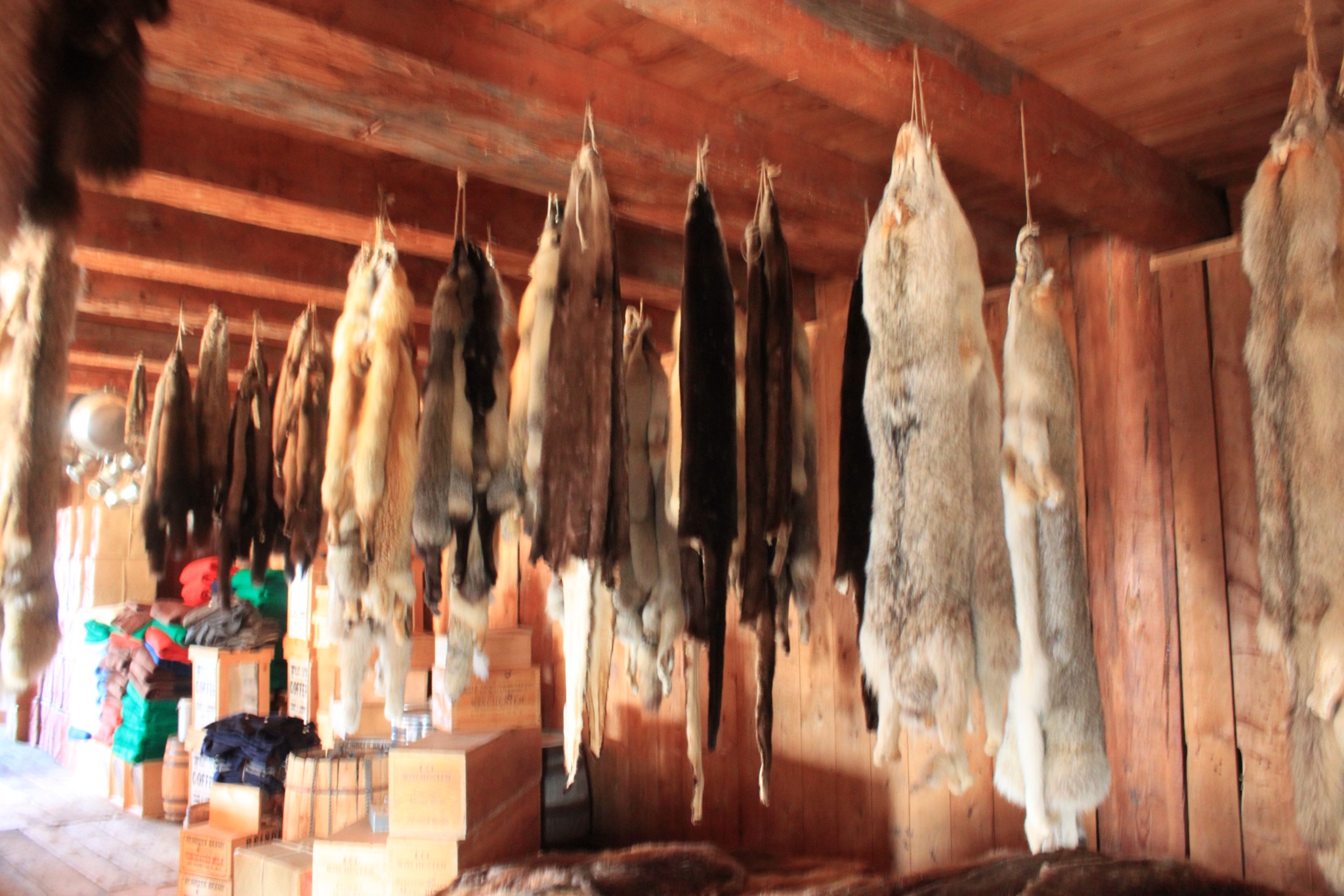
HANGING FURS IN THE WAREHOUSE
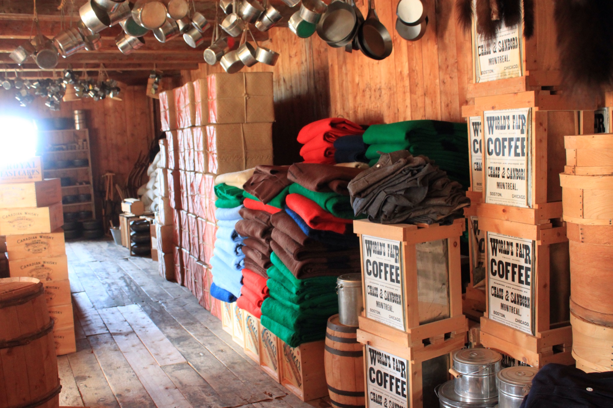
TYPICAL SUPPLIES IN THE WAREHOUSE

STORE FOR TRADING GOODS


TRADE GOODS IN THE STORE
Of interest is the price of all trading was determined based on a “Done Beaver Hide”, defined as a beaver hide that had been scrapped of all meat, etc.
Other buildings at the site included the home of the fort manager, the officers house, the men’s house and fish catch. All were well done both externally and inside. Rooms were furnished in typical 1850’s style. If desired we would be glad to make a second post on the site.
fuhrynlarry
BEAUTIFUL BRITISH COLUBIA
Leaving Ketchikan, Alaska by ferry we made landfall at Prince RUPERT, BC. We traveled east to Kitwanga and then north on the Cassiar Highway with a side trip to Stewart, BC and Hyder, Alaska, where we are now. Yes back in Alaska. When the folks negotiated the border between Alaska and Canada they must have had a reason for drawing the line between two towns two miles apart. The best thing I can think of is now both Hyder and Stewart have salt water seaports. Yes, both have access to the Pacific Ocean by the Portland Canal and Portland inlet. Total length of about 95 miles from the inside passage.
There maybe other crossings from Canada into the United States without a Customs/Border crossing but this is at least one. You do have to go through customs when you return to Canada. Not much of a terrorist threat going to Hyder. It does have a Post Office which means mail from Hyder must go international before it arrives in any of the 50 states, including Alaska.
Port Roberts, Washington is similar. To get to Port Roberts from anywhere else in Washington, going by land, you have to go through Canada. Someone should do a study to determine if there are other cities, either in the US or Canada, landlocked by a foreign nation. Why the USA doesn’t work out a quit claim with Canada leaves me puzzled.
Okay, let me show you a bit of the beauty of this area. Driving from Port Rupert to Kitwanga there are numerous falls cascading off the steep adjacent mountains.

Also several glaciers. Here is the Brown Glacier.

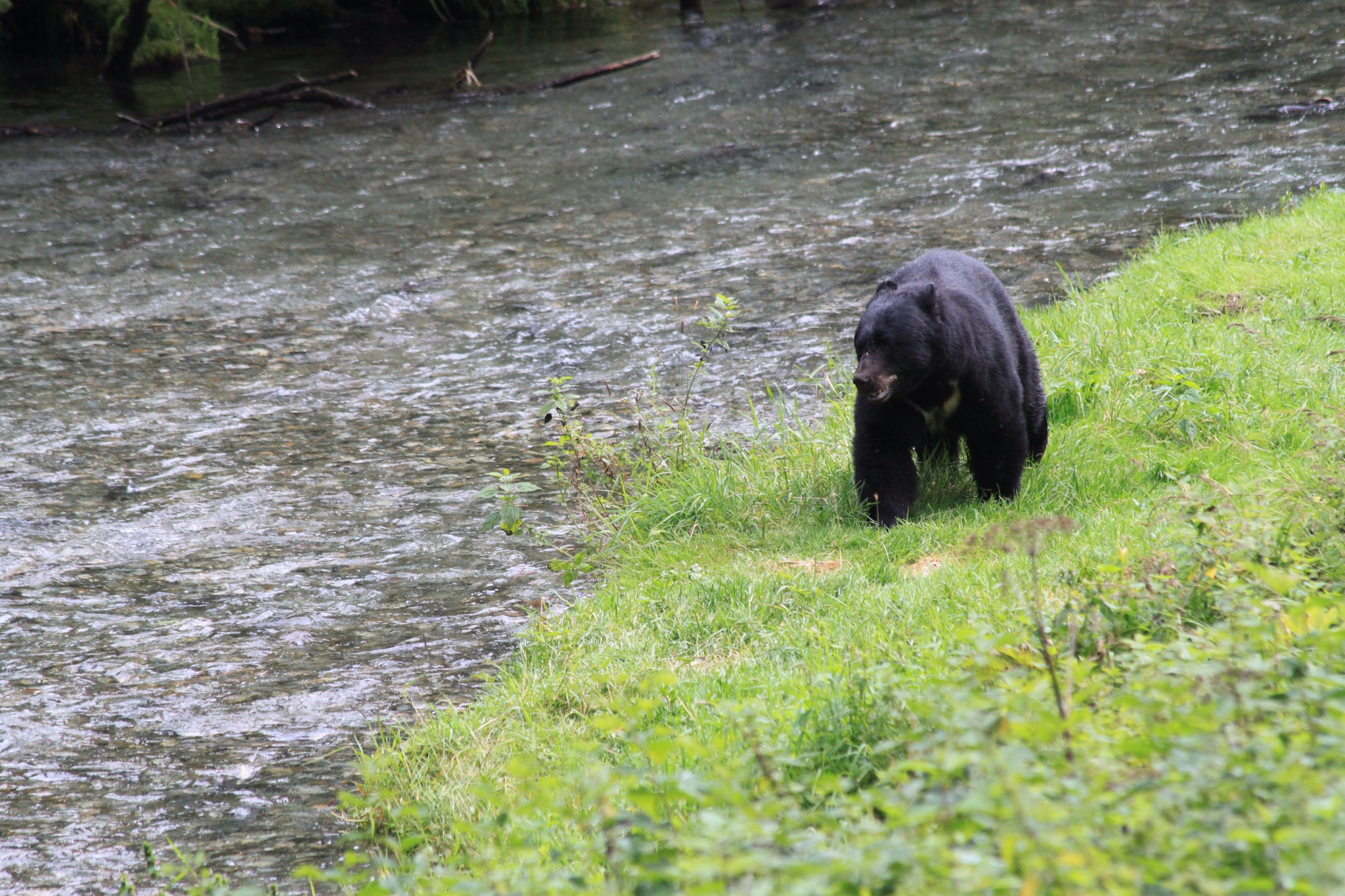
We would show you the Salmon Glacier, the fifth largest in North America, but wanted to show a couple of pictures taken from the wild life viewing area north of Hyder. The water was very clear here and the spawning salmon could easily be seen. It was interesting to watch the females working to scour out a trench to lay eggs in, the male following to fertilize, fighting off other males and the female returning to cover the eggs. It is quite a coordinated process. There was a lot of evidence of how fast the fish die after reaching fresh water. Here it is 10 to 14 days, and the fish are only about 4 miles from salt water. In central Idaho, Bear Valley, the fish have traveled about 800 miles with an elevation gain of 7000 feet, Really very amazing.

We did get to see a black bear walking along side of the stream, but it didn’t seem very hungry.
fuhrynlarry
PS: haven’t had wifi for several days. We are now in Alberta at an info center. We will be able to post again in a couple of days
KETCHIKAN–TOTEM BITE
Totem Bite is a US National Park with the purpose of retaining the Native Alaskan heritage. The tradition of carving Totem Poles was almost lost during the late 1800s. It was still active when Stewart purchased Alaska in 1869, but soon thereafter begin to fade away. The Totem was the vehicle that was used to commemorate various events and to record those events. A totem owner, usually a chief or entire clan would design the totem and have his clan carve it. He would then host a “potlatch” where he would tell the story represented by each part of the totem.
Constructing a totem and hosting a potlatch could take years in the planning and execution. Word would go out to other clans and they would be invited to attend. A potlatch was always a big gathering and may go on for days. Of course dancing, eating, socializing and story telling were part of the potlatch.
Prior to when Stewart purchased Alaska the Tlingits were at odds with the Russians and English. The Tlingits went to war with the Russians, winning a few battles, but losing the war. The Tlingits were happy that the United States purchased Alaska, thereby defeating, in their minds, Russia.
A large Totem was carved in honor of Stewart, and a potlatch hosted in Stewarts honor. Stewart was not aware that when honored in this manner it was customary to thank the Tlingits by hosting another potlatch. If the person being honored did not reciprocate the totem built in his honor would become a totem of shame. An object was attached to the totem indicating the shame and was to remain until the potlatch was conducted. With Stewarts death the obligation was passed down to his heirs. Because of rot the object of shame recently fell off the totem. The word is that the heirs of Stewart will have to stack blankets to the top of the totem before they can conduct a potlatch and have the shame removed permanently.

LONG HOUSE AT TOTEM BITE
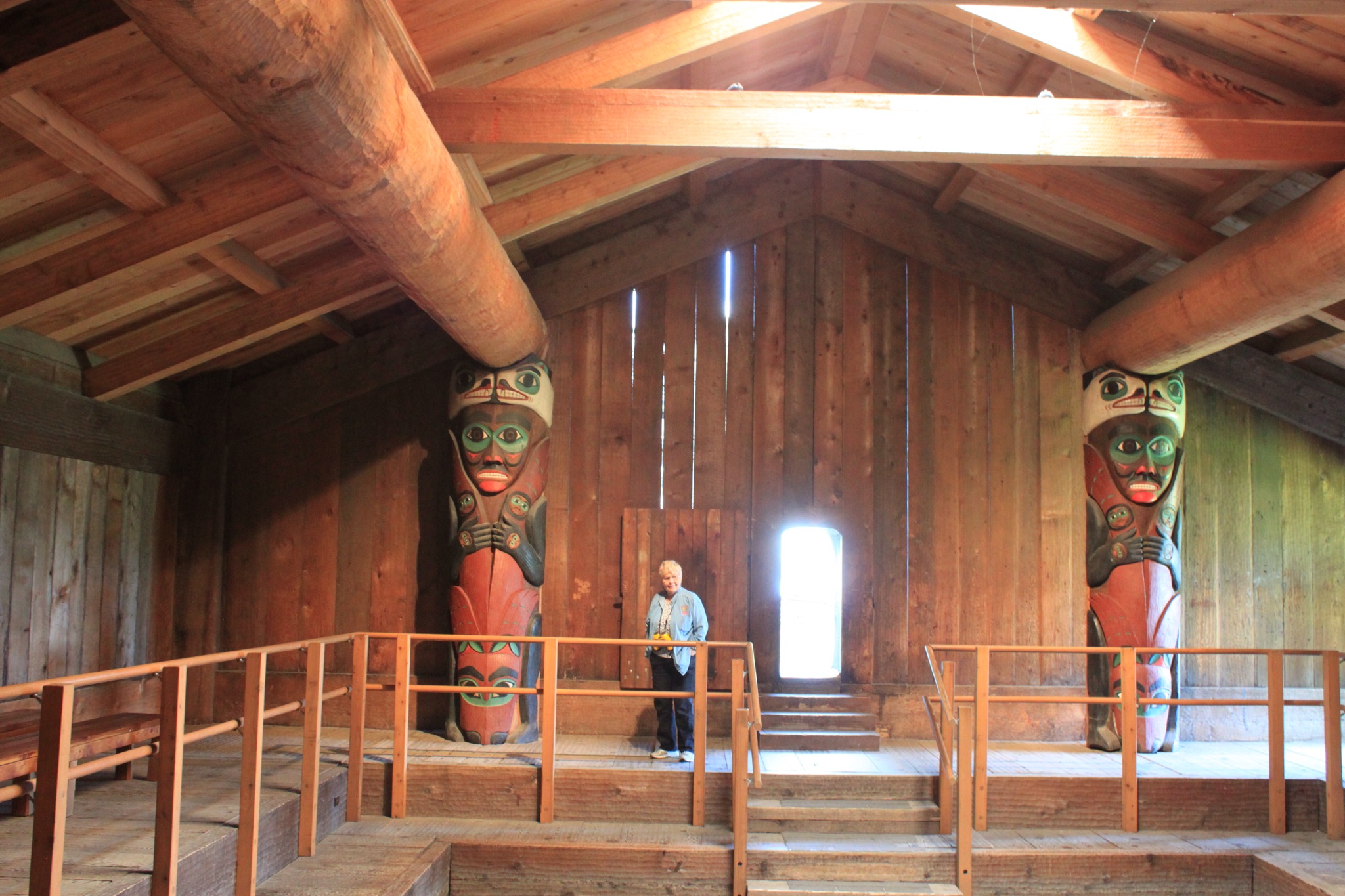
INSIDE THE LONG HOUSE

SUPPORT TOTEM INSIDE THE LONG HOUSE
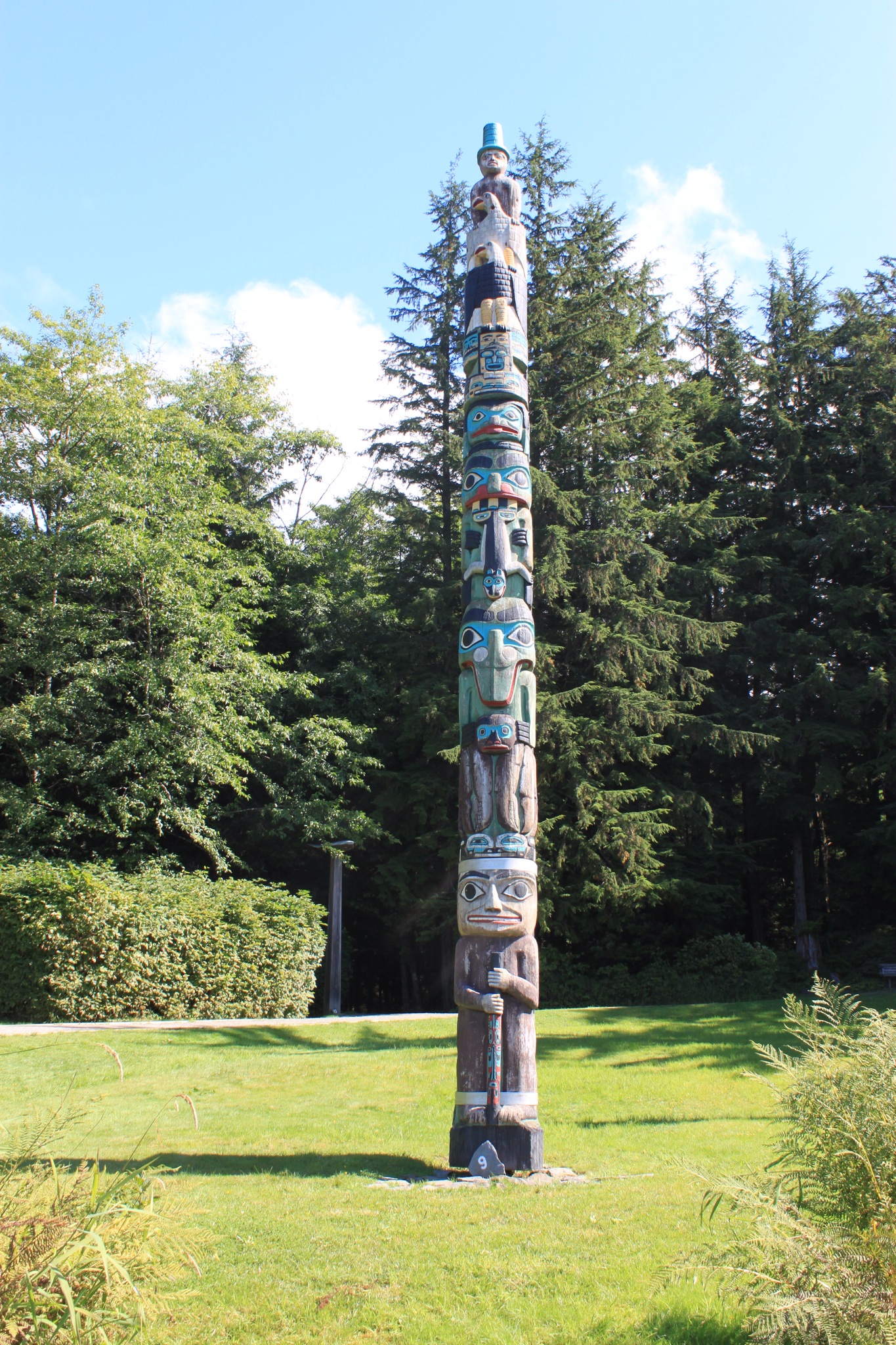
ONE OF THE 14 TOTEMS AT TOTOM BITE
In and around Ketchikan there are hundreds of totems. Way more than we have seen in other cities.
fuhrynlarry
